CARIS Supports Bathymetric Mapping in Atlantic Ocean

In the latter half of 2013 the British Royal Research Ship, RRS James Cook, set sail for the Atlantic to conduct the field work component of a European Research Council funded project, Reconstructing abrupt changes in chemistry and circulation of the equatorial Atlantic Ocean: Implications for global climate and deep-water habitats (CACH).
The expedition was led by principal investigator Dr. Laura F. Robinson from the University of Bristol and also involved Shannon Hoy, CARIS user. The primary purpose of the palaeoceanographic cruise was to collect water and seafloor samples, as well as to perform video surveys with the United Kingdom National Oceanography Centre’s Remotely Operated Vehicle (ROV) ISIS.
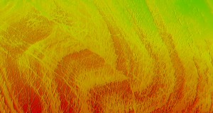
Although shipboard surveying was ancillary to the primary expedition goal, bathymetric data were integral for supporting the scientific operations. During the cruise 75,750 square kilometres (km2) of seafloor was mapped with a Kongsberg’s hull-mounted EM 120 multibeam echo sounder. The sampling areas were primarily in deep, remote waters where prior bathymetric data were either non-existent, unavailable or of poor quality. Therefore a survey of the area was required in order to make informed decisions of where to conduct effective ROV dives. Not only was the bathymetry used for planning, but the information also aided in navigation of ISIS and will be used for scientific interpretation of the collected samples.
As the expedition was science based rather than hydrographic, the survey technique differed from the traditional approach. The aim of the survey was to efficiently maximize seafloor coverage without sacrificing time allocated to the primary project goals or the quality of the data collected. Flexibility of ship routing between deployment sites, as well as optimizing vessel time during gear turnaround, allowed for nearly complete coverage of four previously unmapped seafloor features and an abundance of transit data. All data that were collected, including transit data, were processed on the ship with CARIS HIPS and SIPS. The processed data, as well as the raw files, have already been published via the Pangaea® data release platform. As a result, the bathymetric data for the area covered during this scientific cruise (JC094) are already available for use by others working in the same locations, in hope that this approach will encourage other researchers to share their data with the public.
Press Release, July 29, 2014